Ford Bronco Partners with Google to Map the Entire TransAmerica Trail
Since its inception in 2007, Google's Street View initiative has aimed to create a comprehensive 360-degree map of the world. Over the years, the project has captured more than 220 billion images, covering upwards of 10 million miles across 100 countries and territories.
In a groundbreaking collaboration, Google joined forces with Ford to survey and map the remote sections of the TransAmerica Trail (TAT).
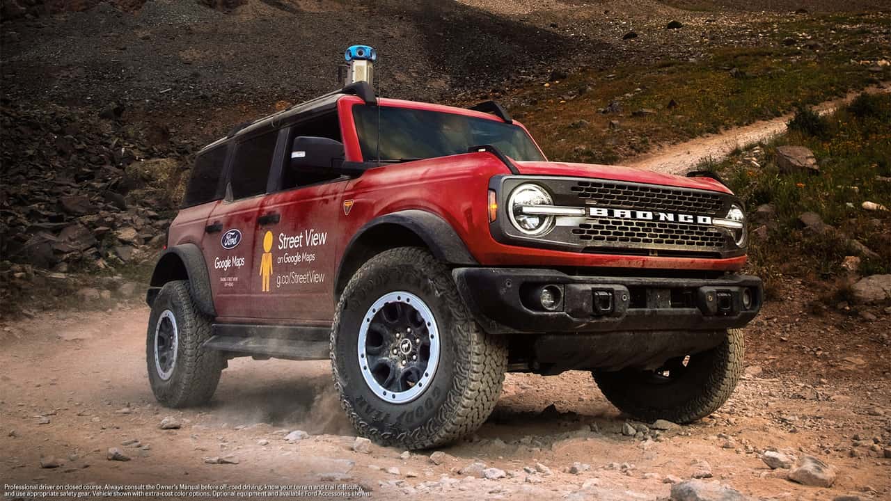
Equipping the Ford Bronco for the Expedition
A Ford Bronco was outfitted with the latest Google Street View camera system. Over the course of 35 days, the off-road vehicle navigated through 13 states, capturing imagery of secluded backroads and isolated terrains. Supporting the Bronco on this 5,900-mile expedition were an Expedition Tremor and a Ranger, which acted as support vehicles throughout the journey.
TransAmerica Trail Now Available on Street View
The entire TAT has been successfully mapped and is now accessible on Google Street View, providing off-road enthusiasts with detailed visuals to plan their adventures. The journey commenced in Port Orford, Oregon, and concluded in Nags Head, North Carolina, highlighting several notable landmarks along the way, including Colorado's Ophir Pass.
Expanding the Partnership for Future Mapping
Ford is set to expand its partnership with Google Maps, indicating that more challenging and hard-to-reach areas across North America may soon be mapped using Google's sophisticated camera technology, which weighs under 15 pounds. While the Expedition Tremor and Ranger did not carry these cameras, the project showcased the Ford SUV and pickup's capability to handle the entire TAT.
Introduced in 2022 and released the following year, the latest-generation Street View camera can be paired with a laser scanner and is compatible with nearly any vehicle equipped with a roof rack. Mapping the full TransAmerica Trail marks the first instance of Google directly partnering with an automaker to chart a specific route.